CHI 2018
Tangible Landscape: A Hands-on Method for Teaching Terrain Analysis
Garrett C. Millar, Payam Tabrizian, Anna Petrasova, Vaclav Petras, Brendan Harmon, Helena Mitasova, Ross K. Meentemeyer
Good morning everyone, and thank you for coming to my talk. I'll be presenting new ways to teach about landscape form and landscape processes using tangible geospatial user interfaces.
Embodied Interaction
Embodied cognition: a link between perception & action
Feeling, action, & thought are functionally integral to cognition
So why use tangible user interfaces to teach landscape form and processes?. Well, lets briefly discuss the theory that motivates the research to follow.
Spatial Education
Spatially-focused curricula = improved student success
Difficult for students to visualize complex landscape processes
Limits students’ success in geoscience classrooms
Why is this?
Recently, spatial education curricula have more frequently been incorporating
spatial thinking techniques to improve students’ problem-solving skills.
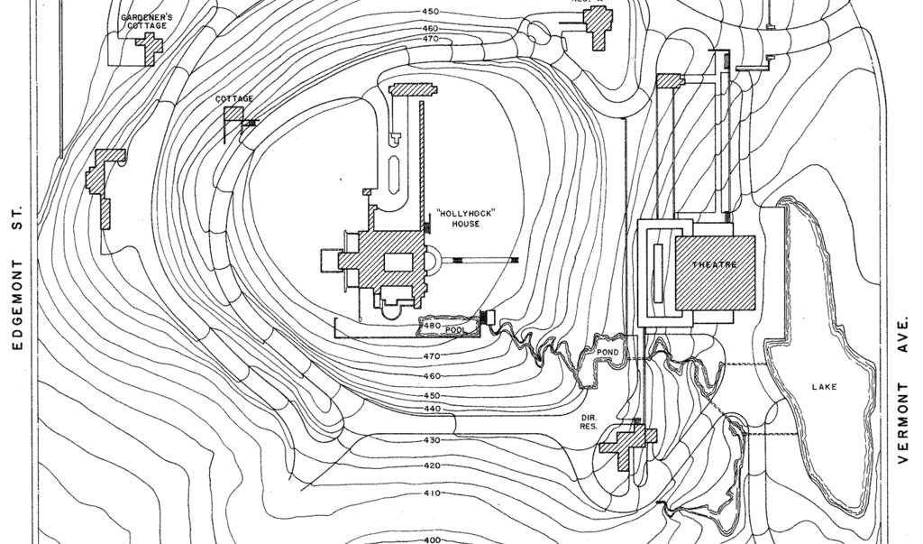
Teaching Methods for Terrain Analysis:
in-situ surveying
drawing contour maps
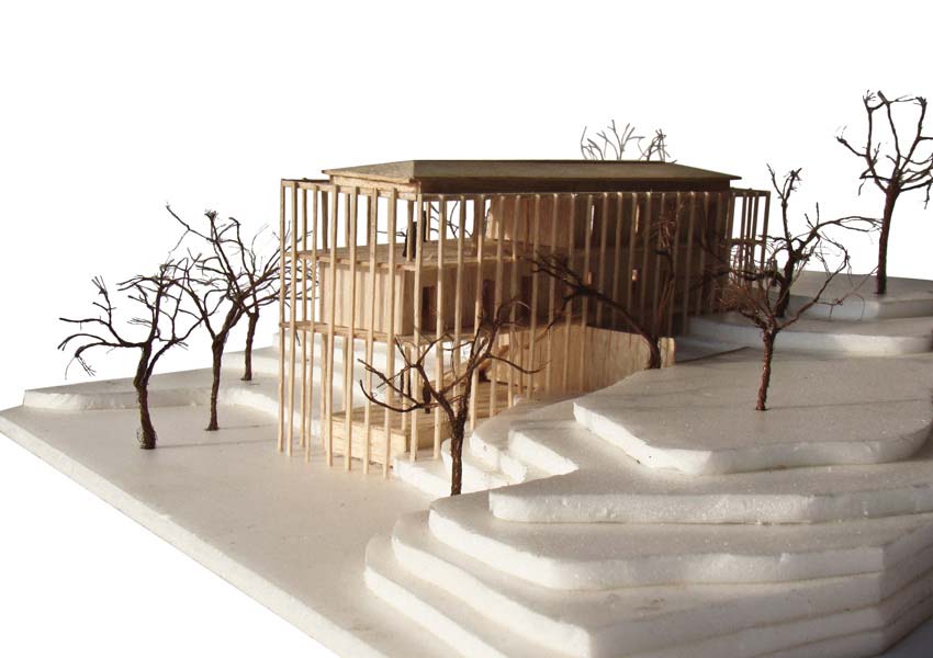
building physical models
Before we get into the misuse of 2D teaching materials, here are a few typical methods used to teach Terrain analysis: On-site Surveying, Drawing of Contour Maps, &
Building Physical Models.
Graphical User Interfaces (GUIs)
Inflexible in use, and inadequate for users to perceive & process spatial information
Limit ways geospatial data can be represented
Solution?
Spatial analyses are also typically carried out with computers, or Grahical
User Interfaces.
Tangible User Interfaces (TUIs)
Offer more natural & intuitive mode of interaction
Allow users to cognitively grasp & physically manipulate 3D
data
Connect intention, thought, action, & feedback
Help students better explore, model, visualize, & think about
complex landscape processes
One solution may be Tangible User Interfaces, as they have been shown to
enhance spatial ability by affording embodied interaction & improving
perception through visual and haptic feedback.
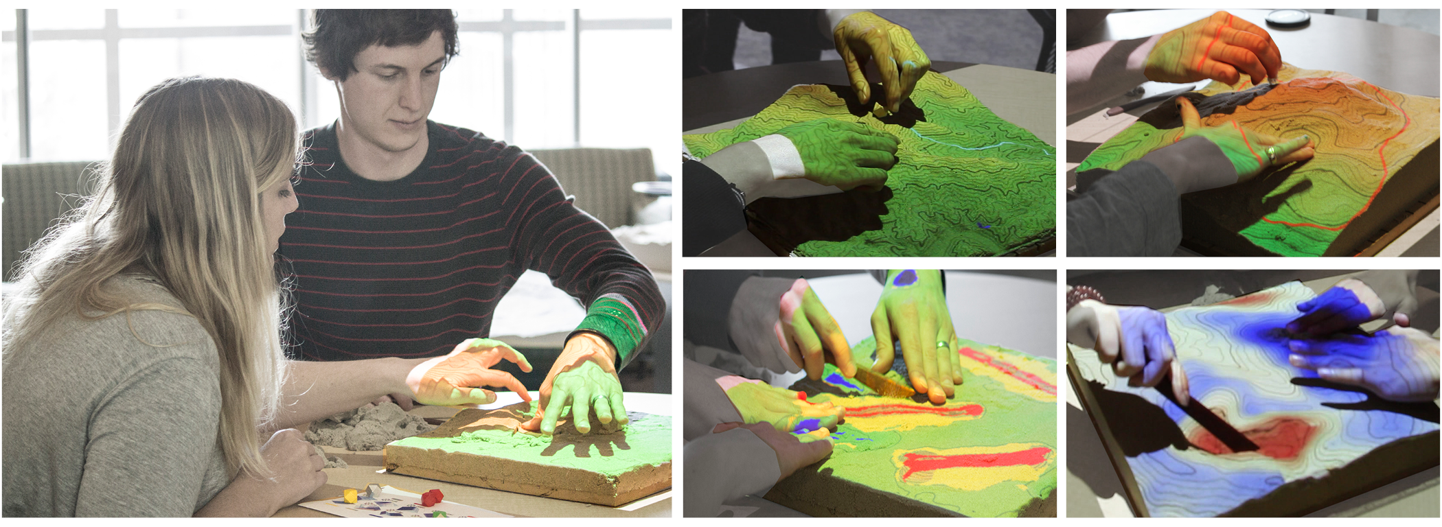
Tangible Landscape:
A tangible user interface powered by open source GIS
One example of Tangible User Interfaces is Tangible Landscape, a system developed by my colleagues at the Center for Geospatial Analytics, at NC State University.
Tangible Landscape: Design & Concept
Your browser does not support the video tag.
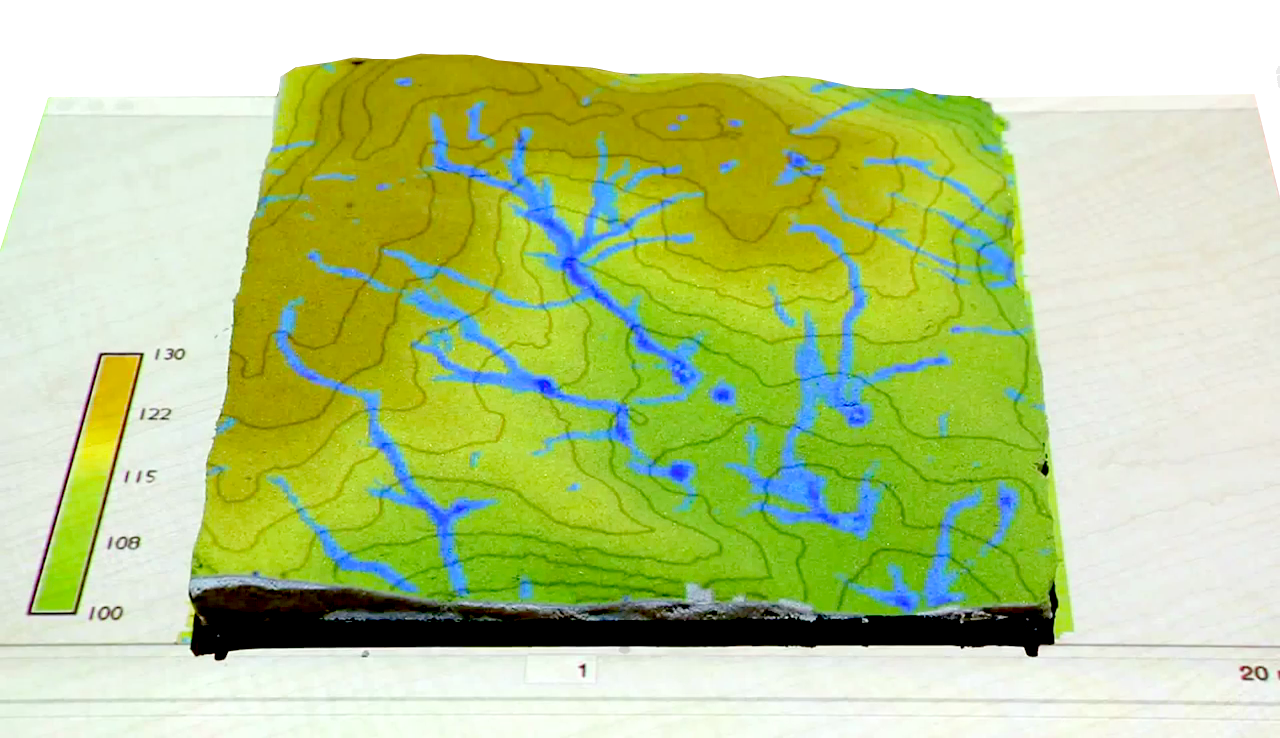
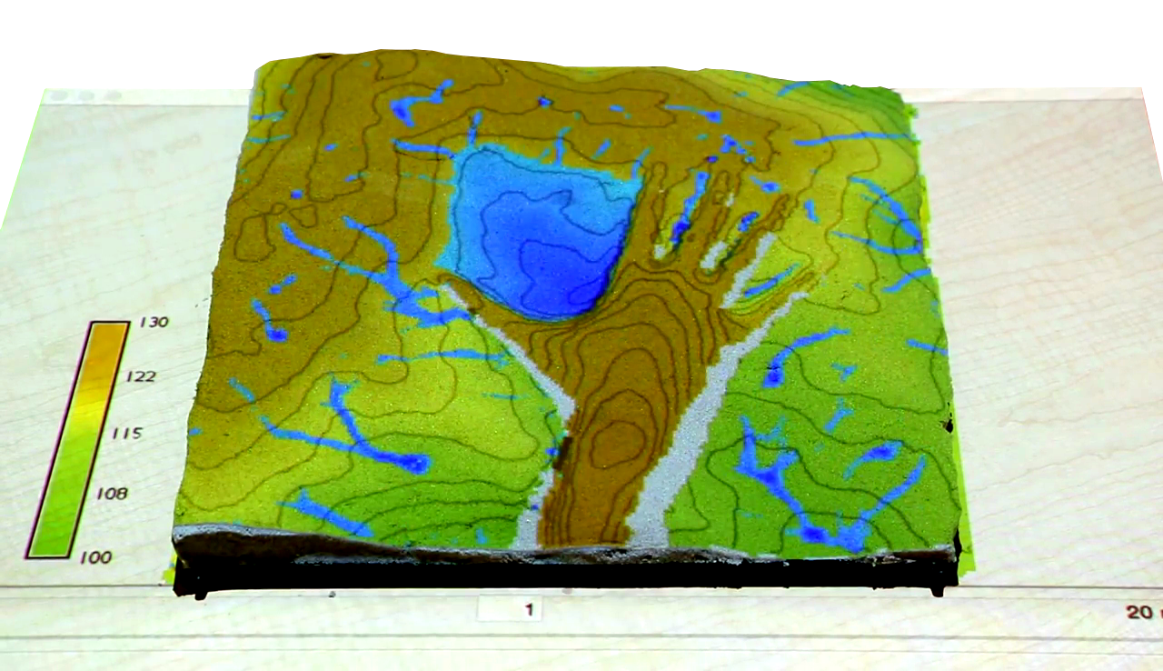
With Tangible Landscape you can hold a GIS in your hands - feeling the shape of the earth, sculpting its topography, and directing the flow of water.
Tangible Landscape uses a physical representation of a landscape which
students can make changes to.
Interactions
Students can physically interact with digital models and simulations by:
sculpting surfaces (hands)
carving surfaces (knife)
placing waypoints (markers)
drawing walking routes (laser)
establishing viewpoints (marker)
planting vegetation (felt)
Tangible Landscape is also unique in that it allows students to interact with a
landscape in many different ways such as building physical models with their hands or a wooden knife or even placing wooden markers as waypoints to design hiking routes.
Tangible Lessons
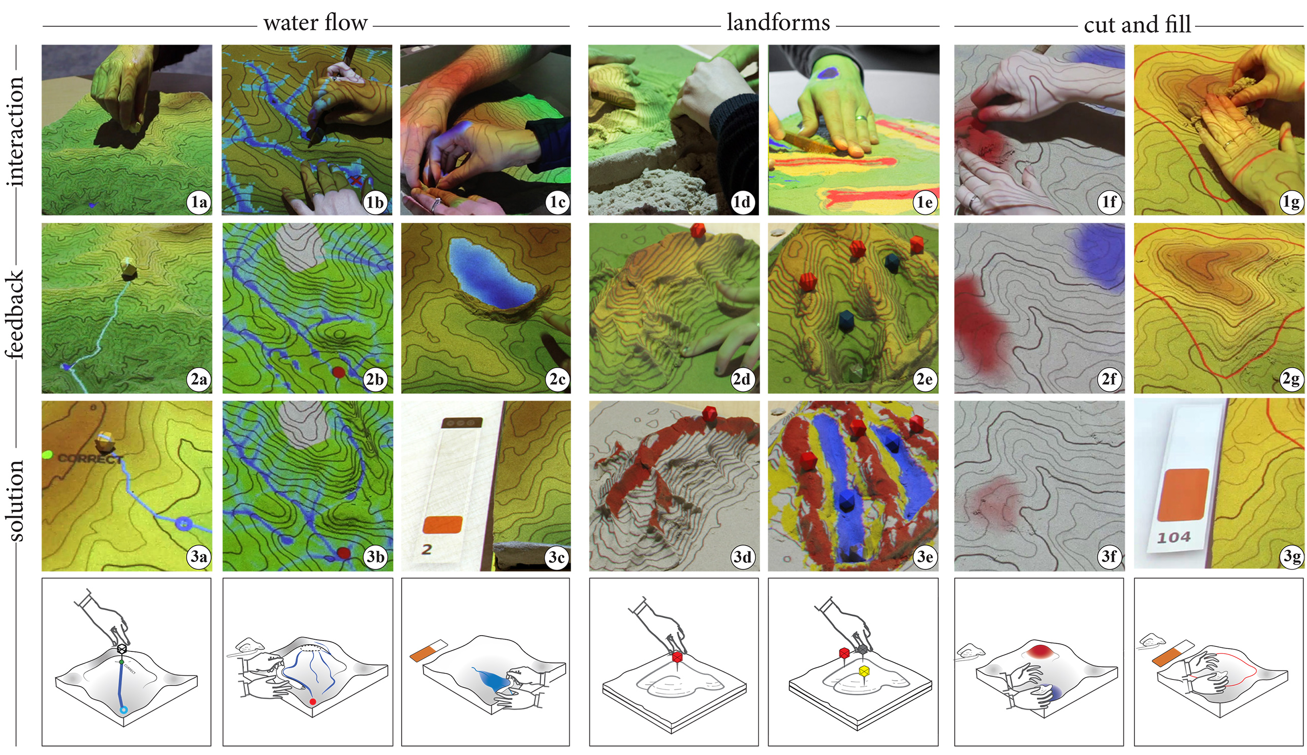
Water flow: flowpath, channeling, & ponding
Landforms: required participants to build & identify landforms
Cut & fill: participants changes landscapes based on provided contours
Using Tangible Landscape, we developed 3 tangible teaching lessons to teach
the concepts of hydrology (water flow), geomorphology (referenced to as Landforms), and grading (or, Earthwork / Cut & fill).
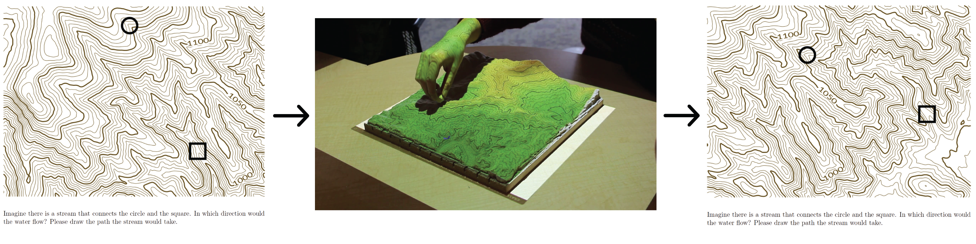
Water Flow
Your browser does not support the video tag.
Flowpath(r.drain)
The first lesson is Water Flow, or Hydrology. It is split into 3 parts... or
"sub-tasks"
Water Flow
Your browser does not support the video tag.
Channeling(r.sim.water)
Second is CHANNELING, where students must modify the terrain surface to make
water flow from the given source point to the given target point.
Water Flow
Your browser does not support the video tag.
Ponding(r.fill.dir)
And the last is PONDING, which requires students to build a damn on a stream
to impound the maximum volume of water.
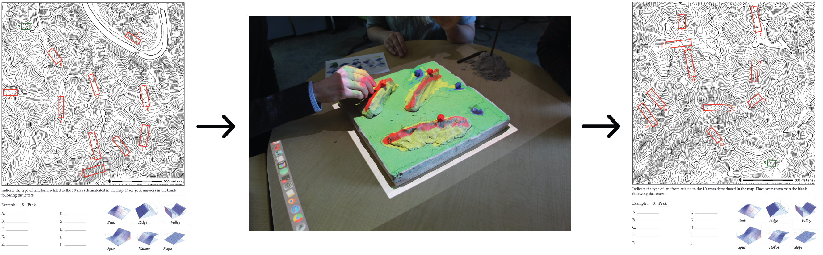
Landforms
Your browser does not support the video tag.
(r.geomorphon)
The second Tangible Lesson is Landforms, which also contains 3 sub-tasks...
simple, compound, & complex landforms.
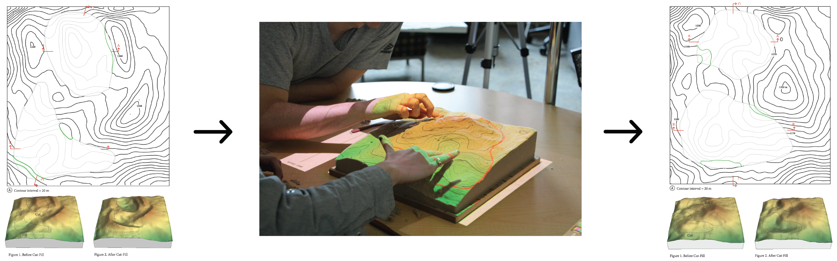
Cut & Fill
Your browser does not support the video tag.
Basic
The third is Cut & Fill, or Grading, where students must try to change landscapes to match a desired elevation based on provided feedback.
Cut & Fill
Your browser does not support the video tag.
Advanced
And in ADVANCED, students must match the desired elevation using only contour lines & grapical feedback (bar graph).
Pilot Study:
Teaching Landscape Form & Processes
Now, lets go through the actual research we conducted with Tangible Landscape.
Research Objectives
Test the effectiveness of a hands-on method for teaching spatial concepts
using Tangible Landscape by:
testing students’ acquisition & transfer of knowledge
examining students’ ratings of the system’s usability & user
experience
In efforts to test the effectiveness of using a TUI to teach spatial concepts (specifically Terrain Analysis),
Procedure
Three, one-week sessions
Contained tangible lessons for teaching fundamentals of grading,
geomorphology, & hydrology
Session format:
paper-based pretest
introduction explaining the lesson content
tangible lessons
paper-based posttest
So, the pilot study was carried out over three, 1-week sessions, each containing their own tangible lesson.
The sessions all followed the same format in that they began with testing the
students' knowledge of the to-be-taught concept, the lesson content was
introduced, students then completed the tangible lesson using Tangible
Landscape, and were finally tested again with a posttest to measure any
potential increases in spatial learning.
Participants
16 graduate students from a Landform, Grading, & Site Systems course
Age ranges:
18-24 (N = 10)
25-34 (N = 5)
35-44 (N = 1)
Voluntary participation during class time
Divided into pairs based on preference
The participants were 16 graduate students from a Landform,
Grading, & Site Systems course, who worked in pairs for the entire 3-week study.
Interaction, feedback, & example solutions
This graphic shows the type of interaction for each lesson, the feedback given to students, and the final solution for them to learn the correct answer (whether or not the task was completed correctly).
Materials & Scoring
Topographic Map Assessment (TMA)
Tangible Lesson Assessments
User Experience Survey
So to assess 3D spatial learning using TUIs, we used the following evaluation methods: the Topographic Map Assessment, 2 Tangible Lesson Assessments, and a User Experience Survey. And I will describe each in detail....
Topographic Map Assessment (TMA) (Newcombe et al., 2015)
Pretest
Tangible Lesson
Posttest
Assessed students’ acquisition & transfer of spatial skills
So, to measure students' overall acquisition & transfer of spatial skills, we
administered the Topographical Map Assessment (developed by Newcombe &
colleagues) in the 1st session & 2 weeks after the last session
Tangible Lesson Assessments
Landforms Assessment
Pretest
Tangible Lesson
Posttest
Measured student’s knowledge specific to content in the landforms tangible lesson
Two Tangible Lesson Assessments were also administered, before & after each
tangible lesson.
Tangible Lesson Assessments
Cut & Fill Assessment
Pretest
Tangible Lesson
Posttest
Measured student’s knowledge specific to content in the cut & fill tangible lesson
Cut & fill assessment: had to highlight areas in the contour map that had
undergone cut & fill operationsand use 3D views & profiles to complete the
contour lines inside a demarcated blank region on the contour map.
User Experience Survey (Ras et al., 2012)
Examined how students perceived and interacted with Tangible Landscape, & how they collaborated to solve a problem
Constructs:
Performance expectancy
Pragmatic quality:
physical objects (wooden carving tools, physical landscape model)
visual objects (projection, digital feedback)
Effort expectancy
User experience
Lastly, to examine how useful students found Tangible Landscape to be for
completing Terrain Analysis tasks, a User Experience Survey was given at the
end of the study. Performance Expectancy: which refers to the degree a user thinks using a system will help them perform well on a task; Pragmatic Quality: Practicality of a system's use, in this case we refer to the physical objects (wooden carving tools, physical landscape model) and visual objects (projection, digital feedback) used during interaction.
(3) Effort Expectancy: known as a system’s perceived ease of use
(4) User Experience: focuses on overall satisfaction, comfort, and perceptions of the system’s effectiveness
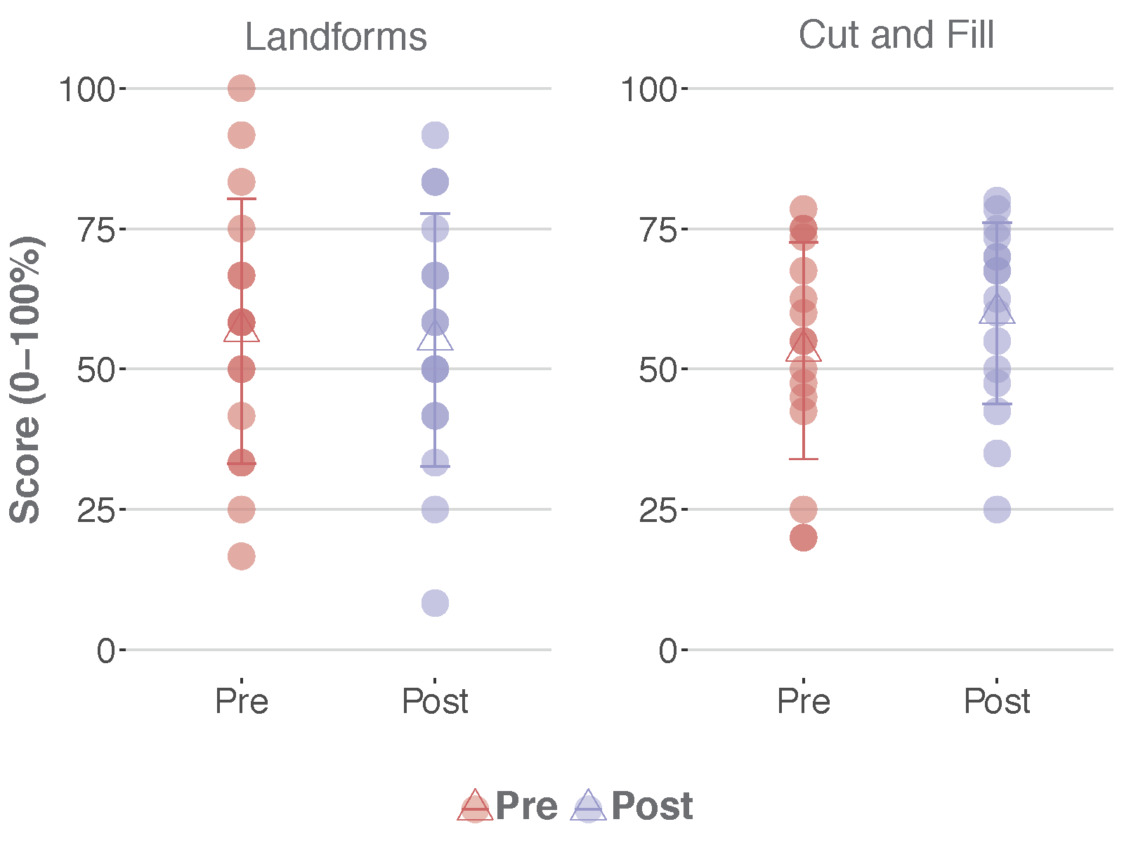
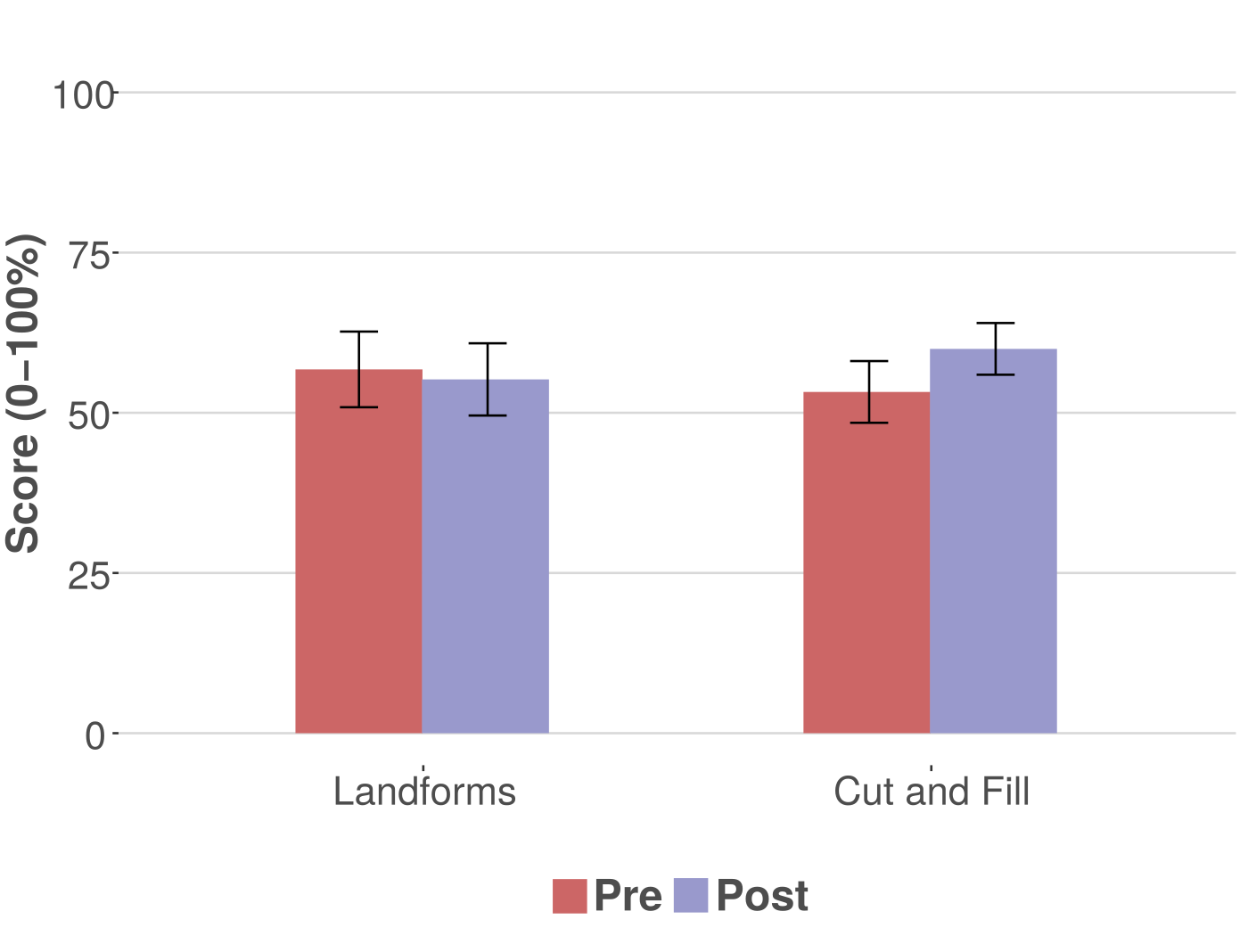
Results
Knowledge Building: Tangible Lessons
Individual Scores
Mean Scores
Here we see the results from comparing students' pre- and post-test scores on
the Landforms & Cut-Fill Lesson Assessments.
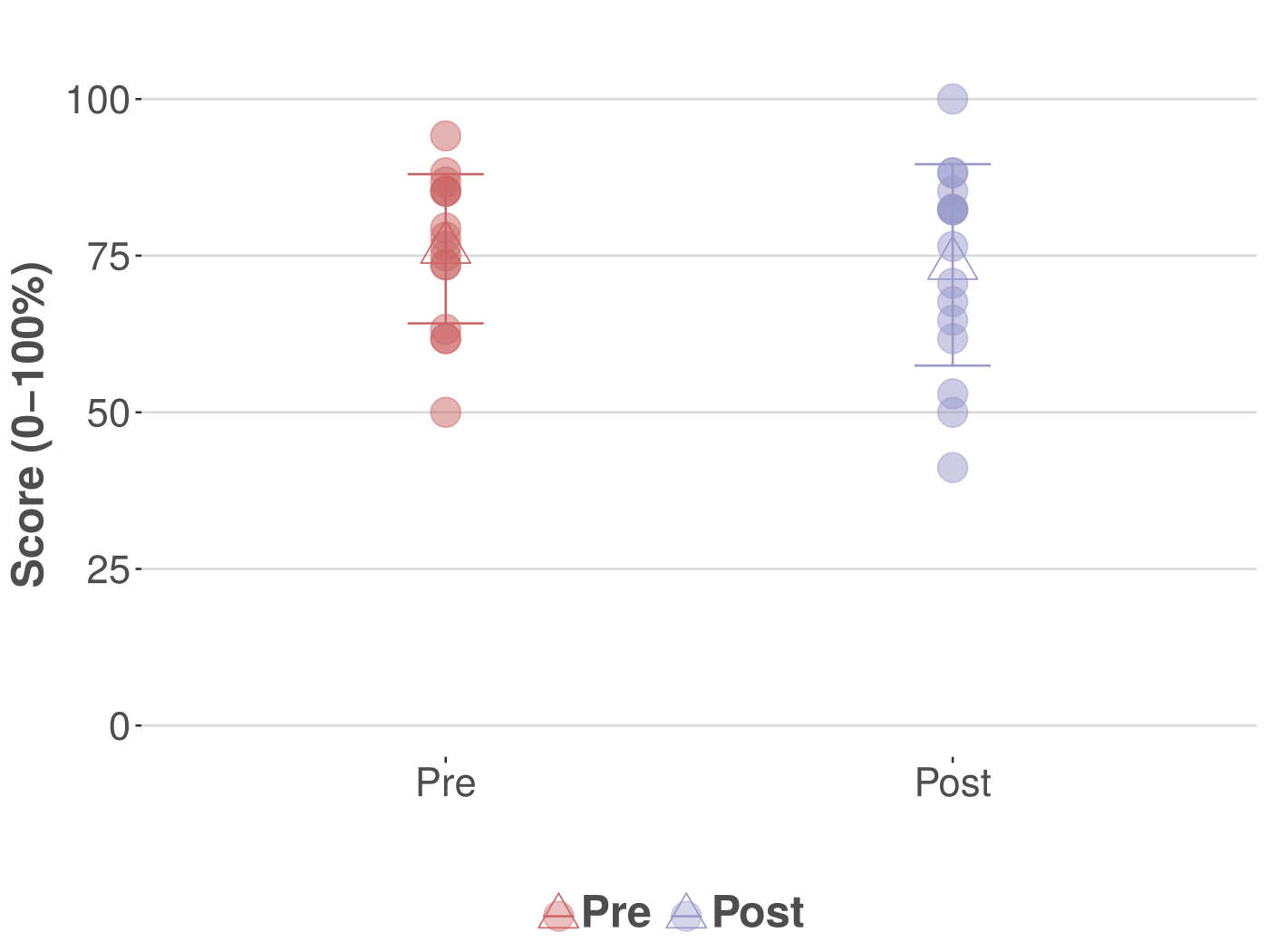
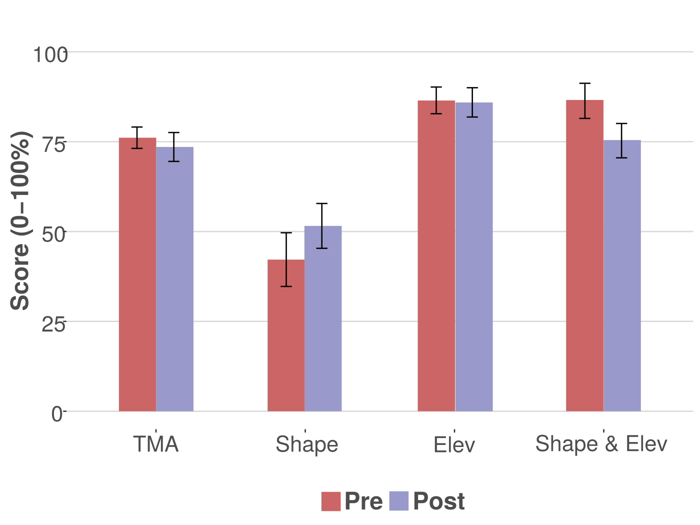
Results
Knowledge Building: TMA
Individual Scores
Mean Scores
For the Topographical Map Assessment, analyses revealed no significant
differences in scored between Pre & Post.
Results
User Experience
All items rated above the neutral value of 4 (out of 7)
Most advantageous aspects of Tangible Landscape?
ability to explore various solutions for the given problems (e.g., water flow, landforms, cut and fill)
physical objects allowed students to change parameters (e.g., location of solution points) very quickly
projected visual feedback helped them better understand the effects of changing those parameters
For the User Experience Survey, it was shown that students rated all of the items above the neutral value of 4 (out of 7); meaning students rated the entire system positively. READ SLIDE
Conclusion
Preliminary evidence for Tangible Landscape supporting improved user experience and marginal, task-specific
knowledge building
Knowledge building:
Ability to directly feel, grasp, and manipulate the various tangible materials
User Experience:
Students can try, see and feel, and directly experience multiple variations of a given solution
Our findings showed that participants performed significantly
better on the Cut & Fill (earth moving) assessment after having completed the analogous task with Tangible Landscape.
Authors
Garrett C. Millar
PhD Student
Payam Tabrizian
PhD Student
Anna Petrasova
Postdoctoral Scholar
Vaclav Petras
PhD Candidate
Brendan Harmon
Assistant Professor
Helena Mitasova
Associate Director of Geovisualization
Ross K. Meentemeyer
Director
I would like to thank my co-authors for their extraordinary contributions to this research, as it would not be possible without them.
Acknowledgments
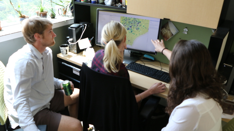
We would like to thank Carla Delcambre of the Landscape Architecture department at North Carolina State University for working with us to implement this study in her course. We also thank the Landscape Architecture graduate students for participating in the study.
Open Source
Resources
Questions?
Thank you!
And with that, I thank you all. While I take any questions you may have, a recent development for TL will be shown in the background: it is the coupling of the physical landscape model with a Virtual Reality viewport. Here you see two users designing a park by first shaping the landscape and then placing colored felt pieces to represent different types of vegetation, placing wood markers to design walking paths, and establishing viewpoints to see what their designed park would look like from the 1st person POV.