Day 1: Introduction to computational science and subject area
You will apply your previous knowledge by first completing both the geospatial and computational thinking assessments. Introductions to the concept of wildfires will then be given, using real-world connections and examples such as the California state wildfires. We will then discuss wildfire properties such as how they are started (geohazards, meteorological hazards) as well as the secondary (e.g., erosion, landslides, changes in water quality, flooding, debris flow) and long-term effects (e.g., cultural and economic resources) of wildfire spread. Brief explanations of how geographic information systems (GIS) can be used as solutions will also be discussed, using a live US Wildfire Activity Web Map.
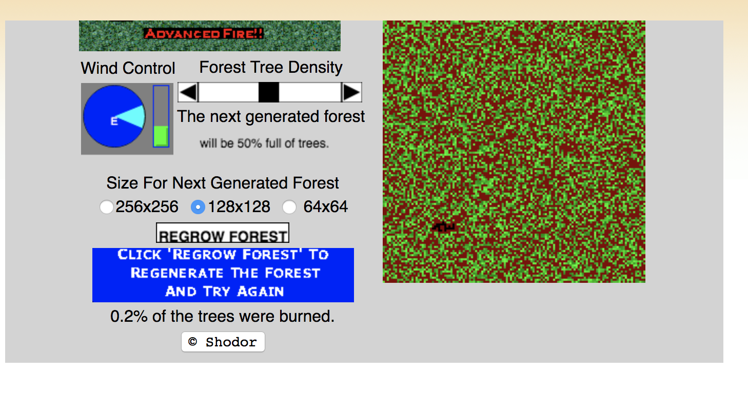
We will then work with a more computational and conceptual hands-on activity, using a computer simulation, A Better Fire. The simulation will introduce you to the concept of geohazards, specifically meteorological hazards, by allowing you to simulate a lightning strike that causes a forest fire. You will use this simulation to investigate the effects of environmental factors such as forest density and wind on the progression and extent of the destruction caused by the forest fire.
Topics
- California wildfires
-
- Wildfire properties
- How are wildfires started?
- Geohazards
- Meteorological hazards
- Secondary effects:
- Erosion
- Landslides
- Introduction of invasive species
- Changes in water quality
- Flooding
- Debris flow
- Damage and/or loss of public and private property
- Long-term effects:
- Reduced access to recreational areas, destruction of community infrastructure, cultural and economic resources
- Benefits:
- Insect pest control
- Removal of exotic (non-native) species that compete with native species for nutrients
- Addition of nutrients for trees and other vegetation provided by remaining ashes
- Removal of undergrowth that allows sunlight to reach forest floor and encourage growth of native species
- GIS Solutions
- US Wildfire Activity Web Map (Live Map)
- GIS Solutions for Wildland Fire Suppression (Info / Learning Material)
Resources
Simulation
A Better Fire (Shown below): This simulation allows students to be introduced to the concept of geohazards, specifically meteorological hazards, through allowing them to simulate a lightning strike that causes a forest fire. Students can investigate the effects of environmental factors such as forest density and wind on the progression and extent of the forest fire’s destruction.
A Better Fire Simulation
Worksheet
Exploration questions worksheet (Open-ended discussion prompts)
Assignment
Use A Better Fire simulation to investigate the effects of environmental factors such as forest density and wind on the progression and extent of the forest fire’s destruction.